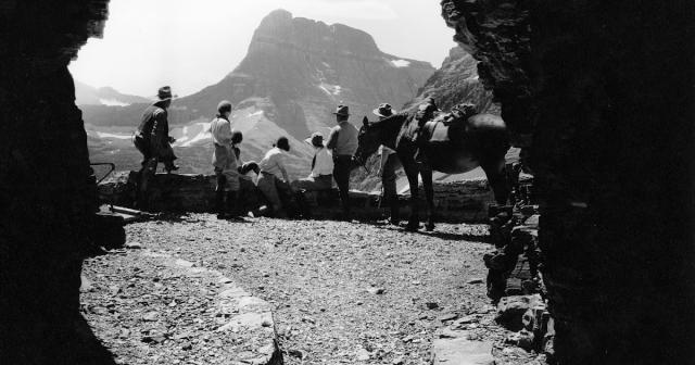
Below are two photos from the historic Ptarmigan Tunnel in Glacier National Park. The 240-foot tunnel was originally built by the Civilian Conservation Corp in 1930 so that hikers, horses and early guided park tours could pass between the Belly River and Many Glacier valleys. The tunnel was bored near the top of the arete that divides the two vallleys, at an elevation of roughly 7255 feet.
Using two opposing steel jackhammers drilling from either side of the arete, and a series of dynamite charges, workers broke through the mountain in less than three months. The blasted rock was used to build doorway entrances, also known as adits, on either end of the tunnel, as well as retaining walls alongside the trail. In 1975 the National Park Service added steel doors to both ends of the tunnel, which now remain closed between October 1st and the opening of the trail, usually around the middle of July.
From Ptarmigan Tunnel's south entrance hikers will have stunning views of Mt. Wilbur, Ptarmigan Lake and the glacially sculpted, U-shaped valley between the Ptarmigan Wall and Crowfeet Mountain. From the north entance you'll enjoy commanding views of Natoas Peak, Crosley Ridge, Old Sun Glacier on the slopes of Mt. Merritt, and the Belly River as it flows into Elizabeth Lake.
These photos were taken by George Grant in 1932, a year after the tunnel officially opened. The horseback party is looking towards the south in both photos:
Jeff
HikinginGlacier.com
TetonHikingTrails.com
RockyMountainHikingTrails.com
Ramble On (2nd edition book on the rich history of hiking)
Exploring Glacier National Park
Exploring Grand Teton National Park

